Can a lightweight AI read Bangladesh’s road signs?
In a 720-image test, a 4.6-million-parameter classifier reached 99.34% accuracy on a new 48-class Bangladeshi dataset. It classified prepared sign images; it did not detect signs in moving traffic or prove safe vehicle use.
Editorial responsibility: The Impact of AI Editorial Desk · Report a factual concern
At a glance
- 1Researchers collected 6,417 original Bangladeshi road-sign images across 48 classes, then used augmentation and balancing to expand the working dataset to 24,000 images, or 500 per class.
- 2BanTrafficNet, a convolutional model with about 4.64 million parameters, reached 99.34% accuracy on a separate 720-image BDTSR test set; test accuracy was 96.97% on the German GTSRB benchmark and 98.82% on the Belgian BTSC benchmark.
- 3This is a prepared-image classification result, not proof of real-time sign detection. The paper does not clearly report whether augmented variants from the same original were grouped before splitting, and it gives inconsistent 224×224 and 96×96 input descriptions.
Research topic
Whether a compact convolutional neural network can classify Bangladeshi traffic signs accurately across a newly collected local dataset and established European benchmarks
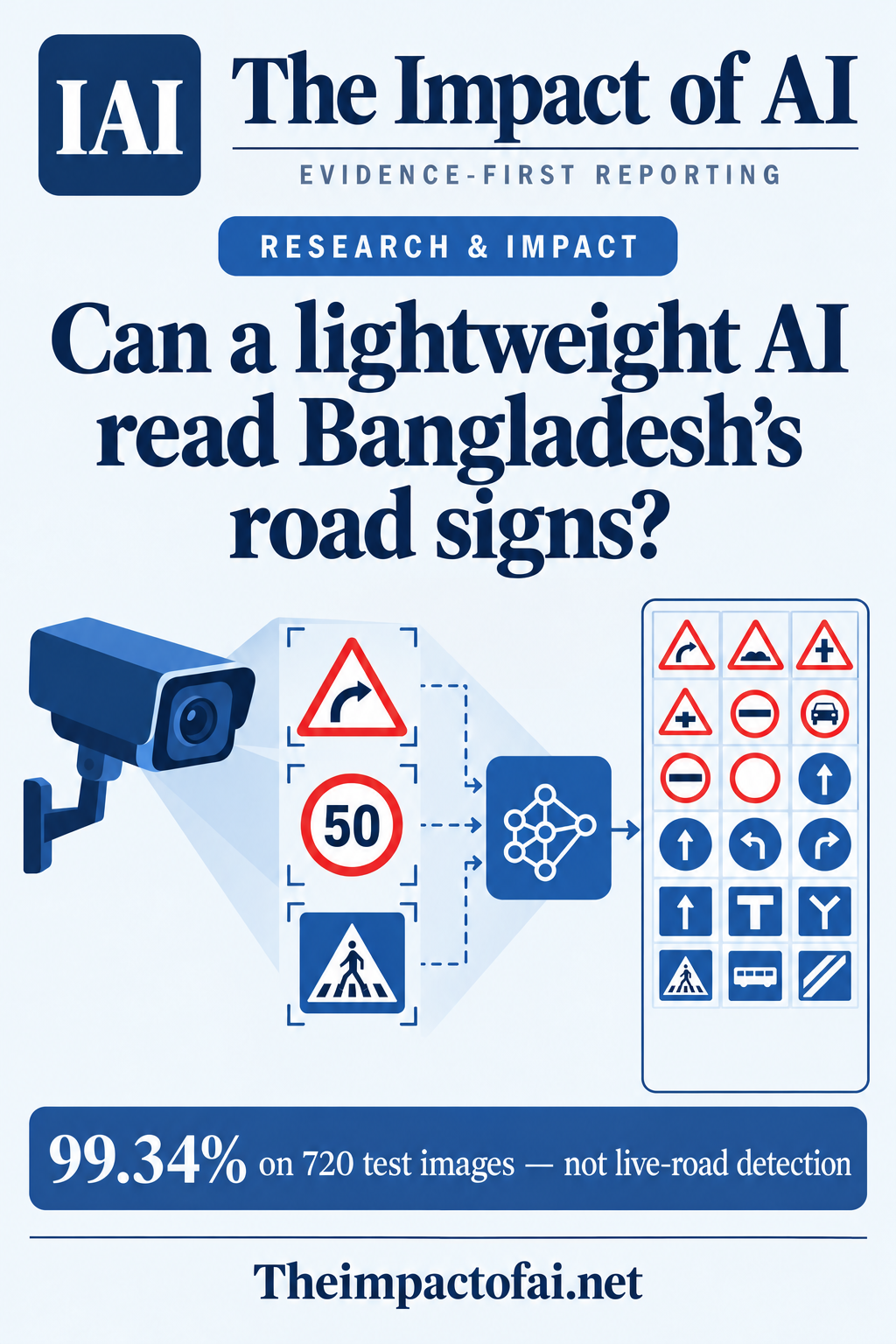
The answer is yes for prepared images, not yet for live roads
A peer-reviewed Scientific Reports paper published on 6 October reports that BanTrafficNet classified 720 held-out images from a new Bangladeshi traffic-sign dataset with 99.34% accuracy. Test precision, recall and F1 were 99.38%, 99.32% and 99.37% respectively. The network contains about 4.64 million parameters, fewer than several large pre-trained image models evaluated in the study.
That result answers a bounded question: given a prepared image containing a traffic sign, can the model choose among 48 Bangladeshi sign classes? It does not show that a camera system can find a small or partly obscured sign in a moving street scene, track it over time, decide when not to answer or improve road safety. The authors list object detection, localisation and on-vehicle field testing as future work.[1]
The Impact Brief · Free
Follow the evidence in technology.
Get a five-minute weekday briefing on what changed, why it matters and where the evidence comes from. Choose the topics you care about.
The dataset starts with 6,417 original road images
The researchers say they manually captured and labelled 6,417 original images of 48 traffic-sign types from Bangladeshi road environments. They cleaned the collection to remove mislabelled or blurry images. That local contribution matters: sign shapes, scripts, maintenance, mounting and street context differ between countries, while many public computer-vision benchmarks are European or North American.
The team then expanded the collection to 24,000 images, balanced at 500 examples per class, using rotations up to 15 degrees, brightness and contrast changes, grayscale conversion, blur, zoom and translation. Augmentation can help a model tolerate small visual changes, but 24,000 is not the number of independently captured road scenes. The evidence base remains 6,417 originals plus algorithmically transformed versions.[1][2]
The evaluation covers Bangladesh, Germany and Belgium
For BDTSR, the paper describes an 80:20 training-validation division, five-fold cross-validation and a separate 720-image test set. It reports 97.87% training accuracy, 99.44% validation accuracy and 99.34% test accuracy. A validation score above the training score is possible when augmentation and dropout make training examples harder, but the pattern makes split construction and repeat-level reporting especially important.
The authors also applied the model to two established European datasets. GTSRB contains 39,209 training images and 12,630 test images across 43 German sign classes; BanTrafficNet recorded 96.97% test accuracy and a 96.36% F1 score. On Belgian BTSC data, described as 4,591 training and 2,534 test images, it reported 98.82% test accuracy and a 97.24% F1 score. These benchmarks suggest the architecture is not limited to one sign set, although they remain curated image collections rather than prospective road trials.[1]
Two reporting gaps limit the 99.34% claim
First, the paper does not state clearly whether all augmented variants derived from one original photograph were kept in the same training, validation or test group. If related transformations of one original appeared on both sides of a split, performance could look better than it would on genuinely new road scenes. The text does not prove that this happened; it does not provide the image-level grouping information needed to rule it out.
Second, the dataset section says every image was resized to 224×224 pixels, while the model section describes a 96×96 RGB input. That may reflect another resizing step or a manuscript inconsistency, but the paper does not reconcile the descriptions. Reproducibility would improve with a fixed preprocessing specification, a manifest linking augmented samples to originals, fold definitions and independently rerunnable test scripts.[1]
A small classifier is only one part of a road system
A 4.64-million-parameter network may be easier to run on constrained hardware than a much larger vision model. That could suit lower-cost driver-assistance devices or smartphones, and the paper includes a screenshot of an Android application. But parameter count is not measured latency, power draw, memory use or reliability on a target device. The article does not report a prospective benchmark on an in-vehicle processor under an operational deadline.
A deployed system also needs a detector to find signs within a full camera frame before the classifier can label them. It must cope with rain, night lighting, glare, motion blur, faded paint, occlusion, unusual viewing angles and signs absent from training. It needs calibrated confidence and a safe failure mode when evidence is ambiguous. None of those requirements is settled by high accuracy on preselected sign images.[1]
What this could mean for people
The immediate public value is a more locally relevant research resource. Bangladeshi engineers and students can inspect the released dataset and code, compare detection pipelines and test whether models fail differently across urban, rural or poorly maintained roads. Better local data can reduce dependence on systems trained mainly on foreign signs and driving conditions.
Drivers should not interpret the result as evidence that a phone or vehicle can now read every Bangladeshi sign safely. A missed speed restriction or a confidently misread warning sign has a different consequence from an ordinary image-classification error. Any consumer or fleet product would require engineering validation, human-factors testing, cybersecurity controls and relevant transport or product-safety assessment.[1][2]
The paper is open, but independence still matters
The study was led by researchers at Bangladesh Army University of Science and Technology, with collaborators at the University of Rajshahi, Pabna University of Science and Technology, Multimedia University in Malaysia and the Berlin School of Business and Innovation. The article declares no competing interests and links the datasets and code through a public GitHub repository.
The author-contribution statement assigns funding acquisition to one author, but the public article page does not provide a separate funding declaration naming a grant or sponsor. That is not evidence of undisclosed commercial backing; it is a reporting detail readers and replicators cannot resolve from the page. Independent teams should test the release before treating the metrics as a stable baseline.[1][2]
What would change the assessment
Confidence would rise if the authors published original-image group identifiers, locked folds and a test set collected after model development from different roads, cameras and seasons. Results should include per-class denominators and confusion matrices, confidence intervals, calibration, abstention performance and errors on rare or visually similar signs. Device tests should report latency, memory, energy use and failure rates rather than parameter count alone.
The decisive next step is an end-to-end trial: detect and classify signs in continuous video from representative Bangladeshi roads, with difficult weather, lighting, occlusion and motion specified in advance. Human reviewers should verify every sign and record missed detections, false alerts and response time. Until then, BanTrafficNet is a useful local dataset-and-classifier result, not a validated road-safety product.[1][2]
What this means for people
- A public Bangladeshi dataset gives local researchers a stronger base for studying signs that global benchmarks may omit.
- Drivers and passengers should not treat image-classification accuracy as proof that a deployed assistance system is safe.
- Transport authorities would need prospective error evidence and clear accountability before relying on automated sign interpretation.
Global context
Traffic-sign AI is often benchmarked on German and Belgian datasets because they are mature and accessible. This study adds a substantial Bangladesh-specific collection and tests the same compact architecture across all three settings. That broadens geographic coverage, but road signs, scripts, traffic behaviour, cameras and environmental conditions vary by country. Locally collected data are a necessary step toward representative systems, not a substitute for local field validation.
What the evidence does not yet show
- The headline 99.34% accuracy comes from a 720-image classification test, not continuous video, object detection or an on-vehicle safety trial.
- The 24,000-image BDTSR total includes augmentation of 6,417 original photographs; it is not 24,000 independent road scenes.
- The paper does not clearly report whether variants derived from one original were grouped before splitting, so near-duplicate leakage cannot be ruled out from the published methods.
- The text describes both 224×224 preprocessing and a 96×96 model input without explaining the transition.
- European benchmark results improve evidence of portability but do not establish performance on prospective Bangladeshi street video.
- The article declares no competing interests but does not provide a separate funding statement despite listing a funding-acquisition role.
What to watch next
- A locked, independently collected Bangladeshi test set with original-image grouping and no derived variants crossing evaluation boundaries.
- End-to-end detection and classification on continuous video under night, rain, glare, blur, occlusion and faded-sign conditions.
- Per-class errors, calibration, confidence intervals and a reliable option to abstain on unfamiliar or ambiguous signs.
- Independent replication, including reconciliation of the 224×224 and 96×96 input descriptions.
- Measured speed, memory, power use and reliability on the proposed phone or vehicle hardware.
Living evidence record
Impact record IAI-12TNPX9
Evidence stage
Studied
Confidence
Supported
Reporting basis
Source analysis
Independent or research support
Present
Record status
Monitoring
Last checked
6 October 2026
Source trail
2 direct sources across 2 source types.
People impact
Documented in this record.
Uncertainty
Limits and next checks are explicit.
Stages describe the evidence available—not whether a technology is good or bad. See the public method.
Related-source reporting disclosure
This record analyses 2 linked source records around the same underlying development. The extra records add method, date or context, but they do not by themselves constitute independent replication of every performance claim or predicted outcome.
Evidence trail
Sources used for this report
Links checked 6 October 2026
This report is labelled source analysis. We summarise and analyse source material in our own words; company statements remain attributed claims until independently supported. Translated summaries preserve the meaning of the original source and link back to it. Read our editorial standards.
Continue the story
Related reporting
Technology
Can interpretable AI tell when a pedestrian will cross?
New analysis today of a peer-reviewed 3 October study on 1,800 labelled pedestrian tracks. A jointly trained concept-bottleneck model produced a small F1 improvement, but one supposedly meaningful concept failed and human intervention behaved unexpectedly; the study does not show safer vehicles or fewer collisions.
7 min · 2 sources
Technology
Can a small AI run a smart home without the cloud?
A peer-reviewed benchmark put one 3-billion-parameter model through 90 simulated smart-home commands and synthetic preference changes. AdaHome beat reimplemented baselines, but no people, homes or physical devices were tested—and responses still took roughly 10 to 14 seconds.
7 min · 2 sources
Technology
Why do multi-agent AI systems keep failing?
An unreviewed analysis of 22,848 closed issues across 21 prominent open-source projects identified 944 genuine multi-agent problems. Handoffs, execution control and memory dominated—but repository reports cannot establish failure rates in production systems.
7 min · 3 sources
Reader commentary
Add evidence, experience or a question
No account is required. Reader notes are published after a brief civility, relevance and safety check; disagreement is welcome.
Explore commentary across the portal →Published reader notes
0No published reader notes yet. You can start the evidence-led discussion above.
Prefer a private correction or response? Contact the newsroom.